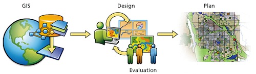
In Dr.Lee’s article, he demonstrate a new area, GeoDesign. “This is one of the newest buzzwords circulating around the GIS community over the past few years”. GeoDesign provides a design framework and supporting technology for professionals to leverage geographic information, resulting in designs that more closely follow natural systems(1). In a word, GeoDesign merges both GIS and design. Carl Steinitz of Harvard University and Bill Miller of GeoDesign Service at Esri both made definitions of GeoDesign. “Changing geography by design” and “design in geographic space”. Thomas Fisher, Dean of the College of Design at the University of Minnesota argued three things that occurred as a result of one invention and the Enlightenment that came from: The partitioning of knowledge into disciplines, the separation of humans and nature and the abstraction of reality. And these changed two big discoveries in 20th century, ecology and computing. GeoDesign brings geospatial computing capacity into the process of design. Using design methodology as spatial planning making of GIS and at the meantime let designers to consider geographic data as a part of creative decision. Some scholars believe that there is a need to move beyond the GeoDesign that it can be taught within the context of existing curricula offered by academic institutions. So that there is an effort begun, like a proposed Bachelor of Science degree program in GeoDesign at University of Southern California, an online extension program in GeoDesign at Pennsylvania State University and so on. There are a lot GeoDesign programs under developing.


(1) Geodesign | Integrating GIS with Geodesign. (n.d.). Retrieved May 19, 2016, from http://www.esri.com/products/arcgis-capabilities/geodesign
Lee, M. (n.d.). Teaching GeoDesign: A Campus-Wide Initiative.

No comments:
Post a Comment